💧
Water
Catchment, tanks, dams, swales, drainage, stormwater, greywater, wastewater and drought resilience.
We design architecture, landscape and regenerative systems together — water, soil, food, shelter and energy — so the property works as one connected living system instead of five separate problems.
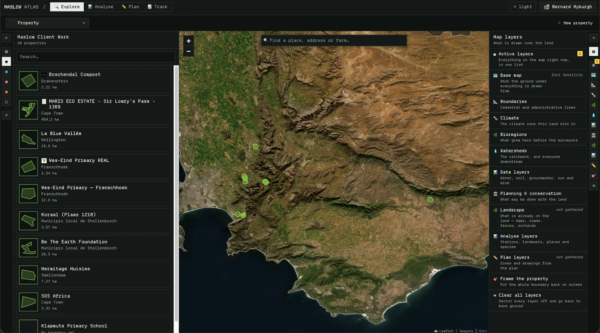
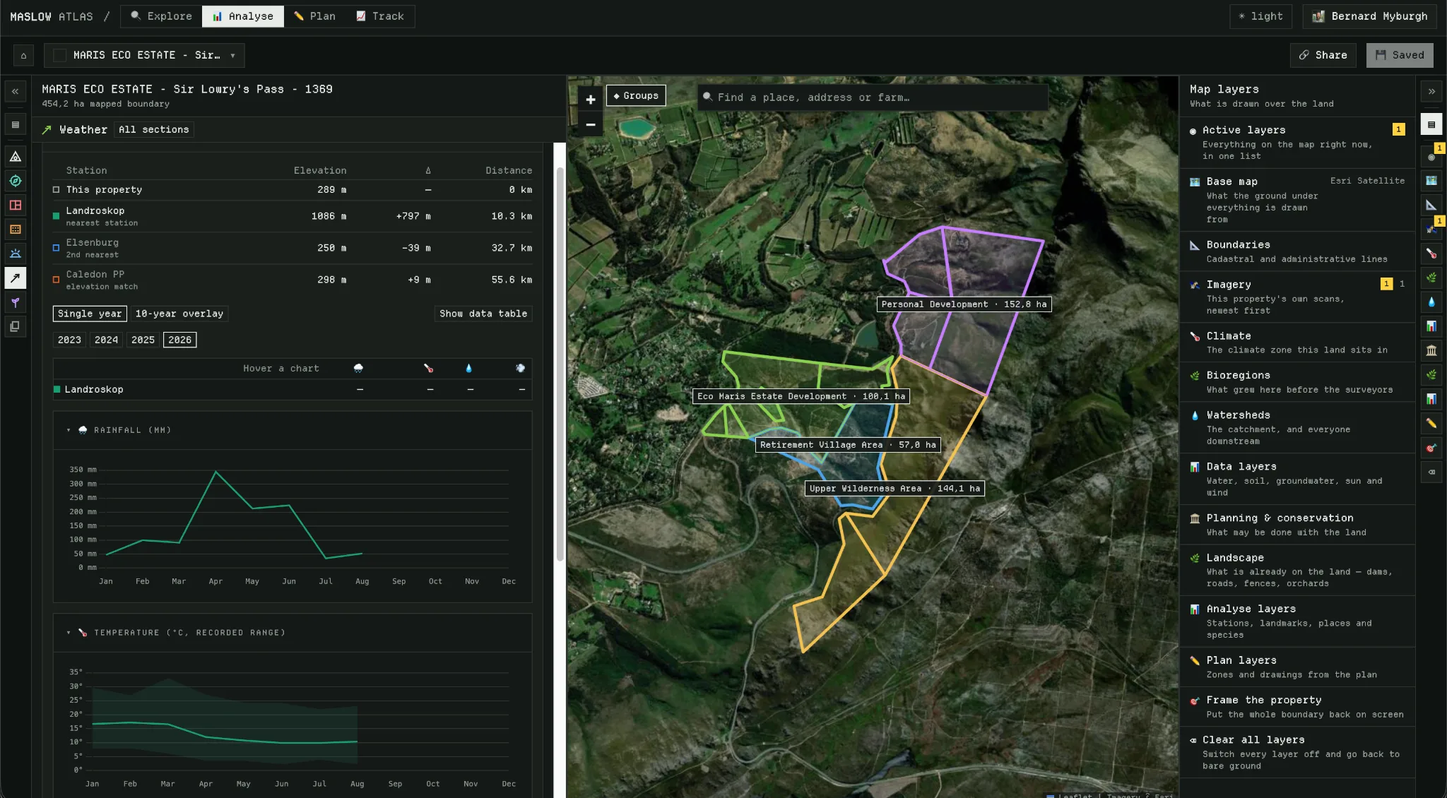
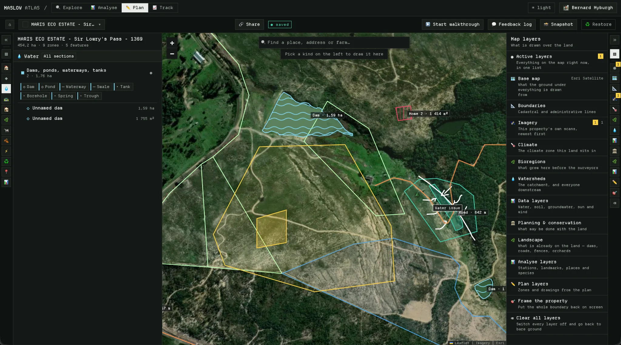
We read the land first and turn complexity into an ordered sequence.
One masterplan lets the work happen in phases without painting you into a corner.
We design the relationships between systems, not just the individual objects.
What is already moving through this place, and how much of that value could we keep in the loop?
Rain can become irrigation. Organic waste can become fertility. Fertility can grow food. Roofs can catch water and sunlight. Trees can make shade, fruit, habitat and wind protection at the same time. When the outputs of one system become the inputs of the next, the property starts doing more with less.
We start with the basic systems that support human life, then design the links between them so every intervention can do more than one job.
Catchment, tanks, dams, swales, drainage, stormwater, greywater, wastewater and drought resilience.
Compost, mulch, biomass, biology, fertility loops, erosion control and the living foundation beneath everything else.
Kitchen gardens, orchards, perennial guilds, syntropic rows, nurseries, animal systems and productive landscapes.
Architecture, modular homes, siting, passive comfort, material choices and buildings designed to support the landscape.
Demand reduction, solar generation, storage and the energy needed to run pumps, homes, workshops and productive systems.
The real value is not a drawing. It is knowing what to do first, what can wait, what each move unlocks next, and how to avoid expensive decisions that fight the land.
Boundary, topography, climate, water, access, vegetation, structures, soil, constraints and the existing opportunities already present on site.
Architecture and landscape are resolved together. We map the system, test options, sequence interventions and define what the property could become.
Earthworks, planting, water systems, fertility infrastructure, access, structures and partner packages — phased according to budget and priority.
As Maslow Atlas develops, the same mapped property becomes the place to revisit decisions, compare progress and keep plans, measurements and observations attached to the land.
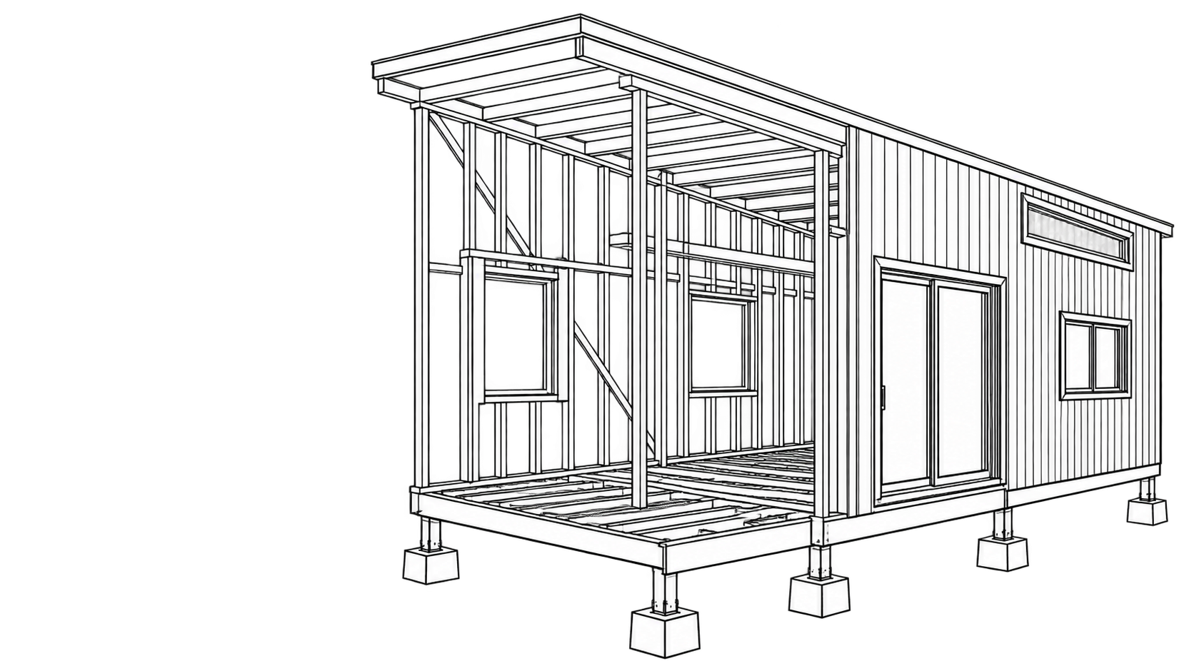
Tiny houses, worm baths, grease traps, chicken tractors and other practical circular products—designed around the property, then scoped as a separate build.
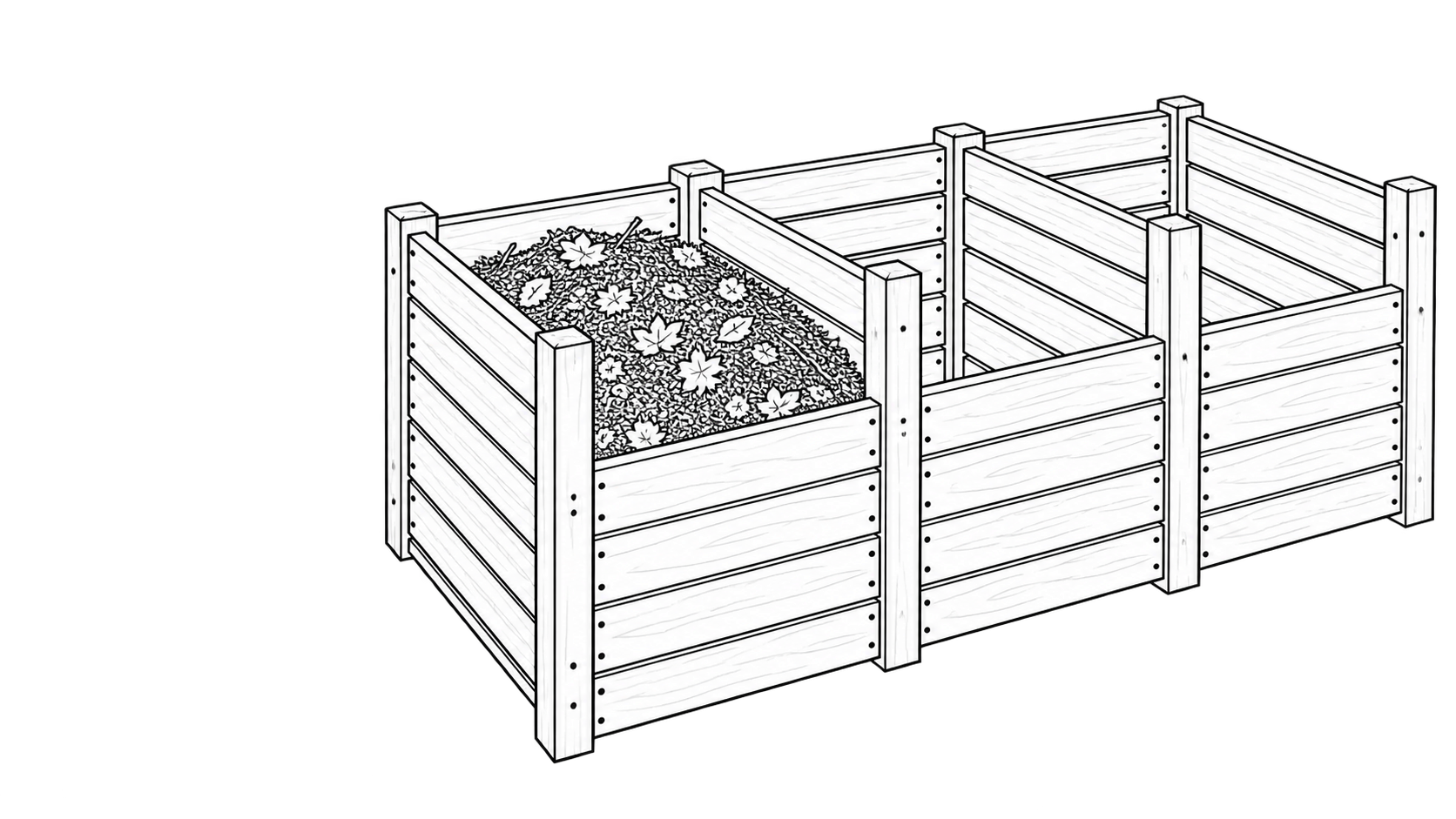
For estates, farms and high-volume sites that need a dependable way to turn organic material into useful compost instead of hauling it away.
Atlas is the workspace behind Maslow's property work: Explore, Analyse, Plan and, over time, Track — all around the same boundary and the same living record of the land.
Instead of handing you a static PDF and disappearing, the direction is a revisitable property record: the climate, the water, the zones, the drawings, the decisions and the future monitoring all anchored to one map.
Measure six simple things: what the property provides, and how much water, organic matter and material value stays useful after first use. Then see where the next ten points could come from.
The score is a conversation starter, not a certification. It helps reveal where a property is still linear and where design can close the biggest loops first.
The scale changes. The logic does not. Read flows, reduce demand, keep resources useful, make the landscape productive, and design every new thing to support what is already there.
Home siting, gardens, water, energy, shelter, food and outdoor life designed together.
Working systems can also become the identity, experience and long-term value of a property.
Use the land analysis to shape roads, water, wind protection, public realm, planting and phased development.
Send us the location and the rough idea. We will look at the property and come back with a first view of what the land is telling us and where we would start.
A pin, the rough size, what is there now and what you hope it could become. We are trying to understand the land and whether Maslow is useful — not make you complete a tender document.
Four short steps. Rough answers are fine.
We will reply with a first read of the property and where we would start. If you have extra maps or photos, reply to the confirmation email with them.
No. A large part of the job is turning a loose dream, a set of constraints and a piece of land into a coherent direction. The earlier Maslow can see the whole picture, the easier it is to keep later decisions connected.
No. The point of a masterplan is to know the final relationships while still being able to phase the work. Water and access usually affect what should happen next, which is why sequencing matters.
Permaculture is one of the strong influences, but the work combines landscape analysis, architecture, water and soil systems, productive planting, implementation planning and digital mapping. The useful part is the integration.
Yes. Circular property design is often most useful as the layer that connects existing disciplines around the land, the flows and the long-term system.
Maslow is based in the Western Cape. Maslow Atlas currently has its deepest data coverage in the Western Cape, and project location can be discussed as part of the first read.